|
|---|
 |
|||
|---|---|---|---|
|
The radar image of the future - radar MOS
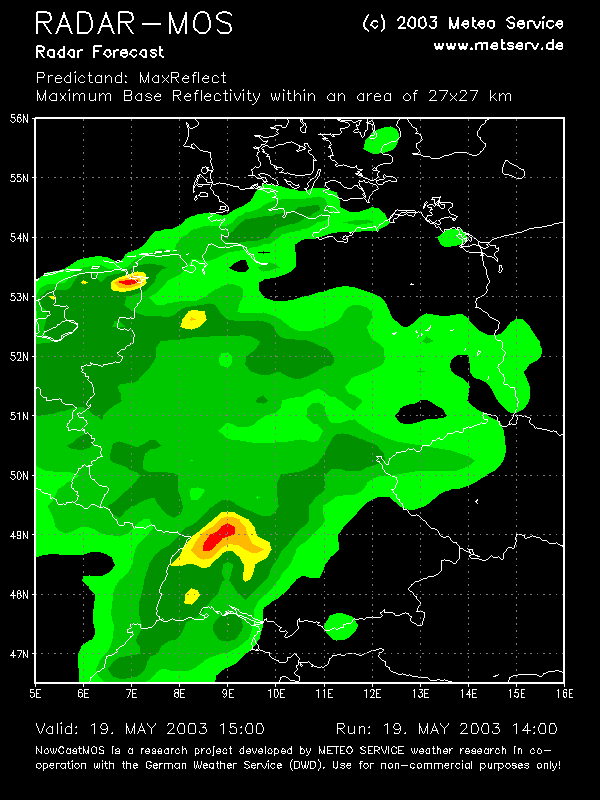
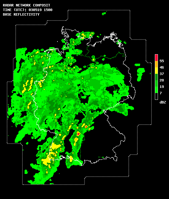
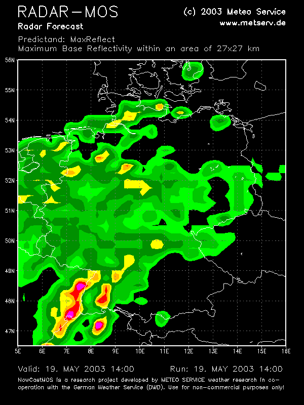
(click on the maps for a larger version) Left figure: radar forecast of radar MOS run at 14 UTC valid at 15 UTC. Predictand "ReflX", highest reflectivity within an area of 27 to 27 km and within 15 minutes. Right figure: radar komposit image of DWD radar network, 15 UTC.
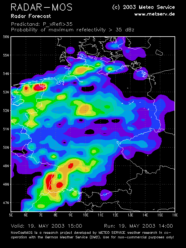
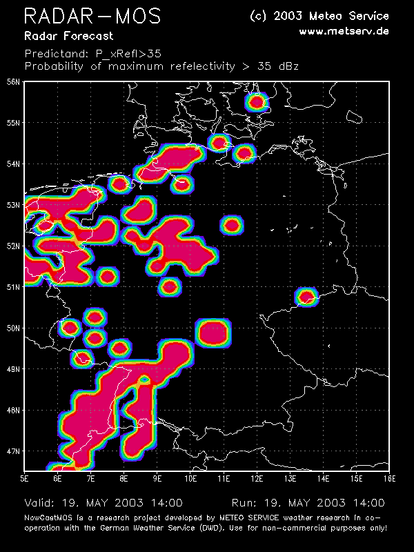
Left figure: radar forecast of radar MOS run at 14 UTC valid at 15 UTC. Predictand "P(Refl>35)", probability of highest reflectivity within an area of 27 to 27 km and within 15 minutes. Right figure: radar komposit image of DWD radar network, 15 UTC.
Left figure: animated forecast sets for highest reflectivity (ReflX). Right figure: animation of probability of reflectivity greater 35 dBZ.
|
|
|||||||||||||||||||||||||||||||||||||||||||||||||||||||||||||||||||||||||||||||||||||||||||||||||||||||||||||||||||||||||||||||||||||||
 |
|||
|---|---|---|---|